FAU Geoexplorer
One Tool for E-Learning and Geo-Publishing
![]()
The provisioning of location-based content for specific places currently is still bound to the technical possibilities of web publications. In contrast, common E-learning tools currently support location-based content only rudimentarily. However, a combination of both approaches is highly desirable for a variety of use cases ranging from university excursions to nature trails to participatory district apps.
With FAU GeoExplorer, we have developed a tool that builds on existing solutions, combining the advantages of didactically prepared multimedia content in a learning environment with the benefits of geovisualization on site.
How we started
Geographic field trips were subject to constraints in the COVID-19 pandemic that called for creative solutions. From digital-only site visits to online mapping services to on-site VR videos that encourage people to explore the site themselves during the presentation, a range of formats evolved to keep field trips teachable
But why not be on site anyway?
Even under lockdown conditions, only the social experience of the group was limited. With a suitable digital tool that, like an E-learning tool, guides the on-site experience according to didactic principles, a visit alone or in small groups was entirely possible. Such a tool also offers the advantage, in the sense of blended learning, of participating in a co-creation process while composing suitable routes and reflecting on experiences made after the actual visit, at least in a shared online meeting.
Such an excursion tool can also be useful in different settings in the future. The use is not bound to university teaching – we aim to use it in the school context as well as for public trails.
Screenshot of the GeoExplorer: on the left the route to the location, on the right the mulitmedia content
Funding and project partners
Main contact:
Various grants have already been obtained for the project:
|
 |
In addition, the first cooperation partners for an interdisciplinary use could be gained:
 |
Features
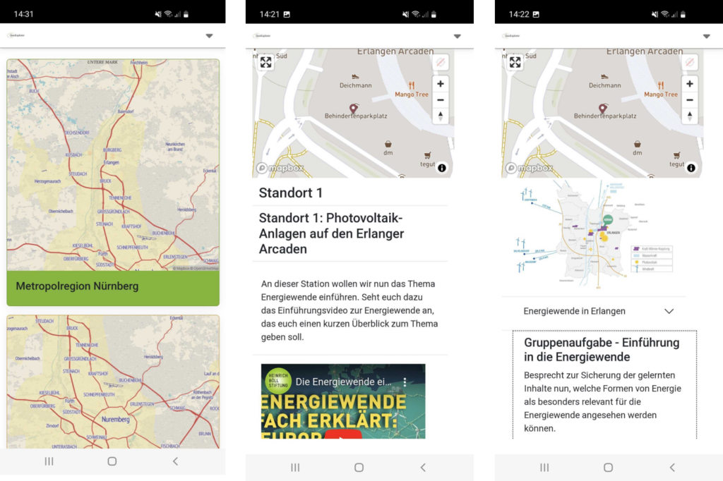
A key feature of FAU Geoexplorer is the parallel presentation of a map view that always focuses on the context of the current location and content from wide range of multimedia that is arranged according to the tasks staged on site. It is most important not to overload the on-site experience with digital content. For this purpose we use:
- a reduced interface, which enables a step by step work with the content
- a recommended route to the next location
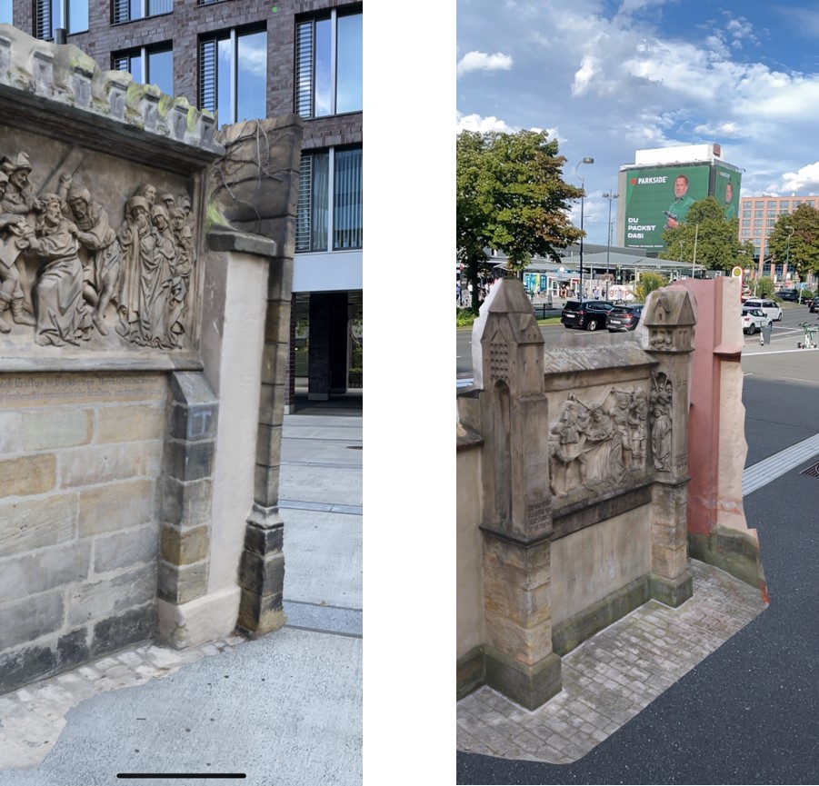
In addition to photos and videos, we also support the integration of 3D and AR-ready models from public databases.
3D models can be viewed as AR content at any place.
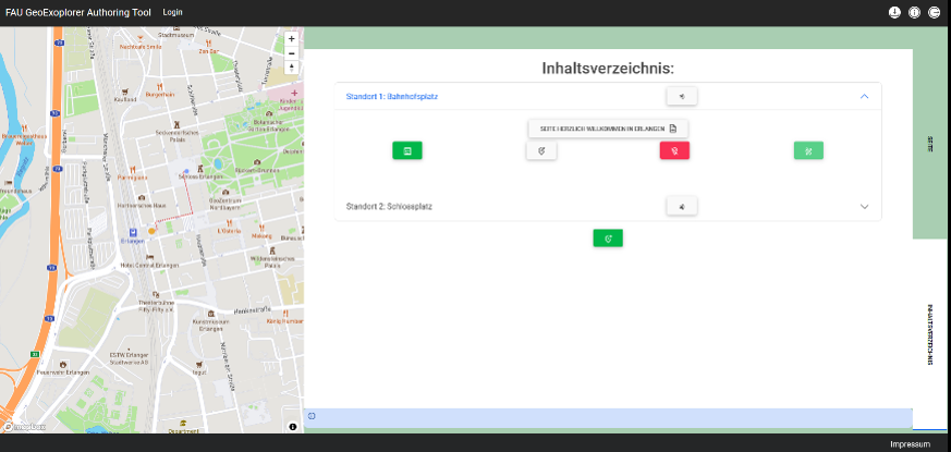
We also offer an input tool for composing the data following a step by step creation process as well. Locations of a route that have already been created are shown next to an easy to use input form.
Interested in a cooperating? Contact us!
Here you can get a first impression of the input form and existing routes.
Literatur
Kremer D. (2022): WebGIS meets E-Learning. Werkzeuge für digital unterstützte geographische Exkursionen. In: Bröll L., Erdmann J., Egbert B. (Hrsg.): Bildung auf Distanz: (Medien-)Technologie, Politik und Lebenswelten in aktuellen Lernprozessen (=e-culture 29). Berlin: 43-54.
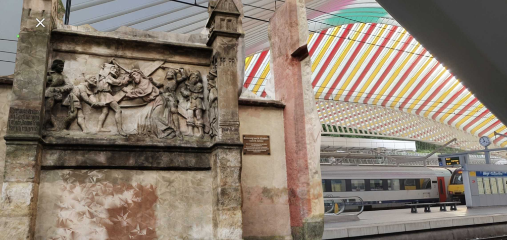
Verstegen U., Kremer, D. (2023): The Nuremberg Stations of the Cross. Enriching On-Site Experiences of a Historical Pathway by the “FAU GeoExplorer” App. In: Münster S., Pattee A., Kröber C., Niebling F. (eds): Research and Education in Urban History in the Age of Digital Libraries. UHDL 2023 (=Communications in Computer and Information Science 1853). Springer, Cham: 207-219. https://doi.org/10.1007/978-3-031-38871-2_12
Kremer D., Wagner A. (2023): Co-creation of Place-Based Content for Field Trips and Public Trails by Geo-Content Management. Fourth International Symposium on Platial Information Science (=PLATIAL’23). Dortmund, Germany. https://doi.org/10.5281/zenodo.8286273